Friday, January 30, 2015

Weather Will Impact Super Bowl XLIX

Temps in the low 70s and clear skies are just 2 of the things players will have to contend with at Super Bowl XLIX.  They will also have to contend with breezes upwards of 5 mph.

Both these teams are playing outside their element.  Seattle is used to cloudy skies and winter time temps of about 50.  The Temps will be equivalent to those of record highs, and the sunshine will be a strange challenge at kickoff.


Marshawn Lynch was asked by Sal Palantonio if it was true that he came to the media room to escape the hot Arizona sun, and he confirmed the reporters question, replying "You know why I'm here."  We can see that these weather conditions have already gotten into his head.


Speaking of heads, Tom Brady's is showing signs of the dry Arizona air.  These arid conditions are NOT the norm for this hearty New Englander.  Is sure to have his hands full with dry, comfortable conditions, and a small potential for NFL legally compliant footballs, though current models show that scenario as unlikely.

To get some insight into what awaits our foes this weekend, we went to CCWI Tucson Correspondent Marx "Scoops" Loeb:

"I think the Seahawks will be better prepared for the weather.  While they ARE used to rain, the intensely mild heat should not be as much a distraction to them.  If you are used to New England in February, and you come to Arizona?  Well that is just not something you can practice for.  I know.  I am from New England and am STILL not used to these mild winters. Back to you, Dave."

The bottom line is, it will simply come down to whichever team handles the extreme fair conditions best, will be the one to walk away with the trophy.

Some Weather Related Over/Under Prop Bets:
(Courtesy of Reno Rob, Fantasy and OC Golf Insider Staff Writer)

Temp at Kick-off :
72 degrees

Clouds visible in the sky at kick-off:
3

Head coaches wearing a golf shirt:
1

Number of times Al Michaels will mention the perfect weather conditions after kickoff:
3

Number of turnovers NOT induced by weather conditions:
3

Number of O/D  starters on both teams combined wearing long sleeve under armour:
3

Time remaining on Clock when the first passing Gatorade Shower occurs:
1:24


Thursday, January 29, 2015

Winter Blast Rivals Blizzard Totals!

As we prepared our hard hitting fact filled investigation of how the Extreme Fair Weather projected to hit Arizona on Superbowl Sunday could impact play, breaking news interrupted our efforts.

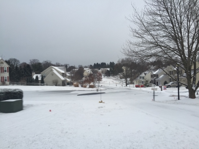
Yet another Arctic Blast ripped through the area this evening, and although it came with less fanfare than The Snowmageddon series, it produced equally treacherous driving conditions.


West Chester Pa was as prepared as they could be, brining ahead of the storm.  But despite all the prep, roads still became wet with melted snow as the storm passed quickly through the area forcing those to ride it out for 90 minutes.


There were reports of a band of snow blowing across broad street this evening, but further investigation by weather watcher Nancy Ripley confirmed it was only a string band wrapping up New Years festivities.


Satellite images show we were once again spared the brunt of the storm as the mother load passed just north of us.

(Photo credit weather watcher Marybeth Jenkins)

While roads were just wet, elevated surfaces such as trash can lids and picnic tables remain slick with rapidly accumulating coatings... We recommend avoiding driving across such surfaces.  And under severe conditions as these, we advise not letting your Littlest Pet Shop Pets (tm) out for extended periods of time. 

Stay tuned for reports of Extreme Fair Weather expected in Arizona on Sunday, and how 2 foul weather teams plan on dealing with it.  Also, we gear up for what COULD be Snowmageddon 4.0, starting Sunday into Monday!


Wednesday, January 28, 2015

Exposé! Insider Finds REAL Forecast Flaw


What Happened to the Snow?!

We, at the Insider, are tuned into YOU. While we were thrilled to report on the havoc and mayhem that raged across our area in the past few weeks, many of our readers were perplexed by what some feel were inaccurate predictions. But the big question being asked by all the major weather outlets is "Did We Get it Wrong?"
We are happy to say we did NOT. We were on top of this storm from the beginning and did not make any predictions about snowfall totals until we could say with absolute certainty a range and the probability for that range (See weather map in previous post).

That said, we are not so arrogant as to ASSUME we are the ONLY news outlet you rely on. And since that is the case, we felt we owed it to you, to try to figure out where things went awry for our fellow meteorologists and the weather models they enjoy gazing upon.

Various outlets have tried to explain exactly what happened. We find it disturbing that some weather people are actually APOLOGIZING. We KNOW weather forecasting as among the most challenging things for mankind to predict. If it were easier, lines could be set and wagering at your local Weather Book would be part of our culture. There is no need to apologize when weather professionals were SO CLOSE to getting this spot on.

Some Explanations:

Nick Wiltgen of The Weather Channel explains, "We were beaten by the snow band. Snowfall forecasting involves the intersection of many variables on scales from local to global: atmospheric pressure patterns, wind directions, air temperatures at various levels of the atmosphere, and the amount of moisture in the air." 


As you can see above, these are VERY complex calculations indeed, that even weather SUPER models would have trouble dealing with.

"Winter storms almost always exhibit sharp edges, or gradients, in snowfall,” says Jonathan Erdman, a digital meteorologist at The Weather Channel. "In Juno's case, the gradient in snowfall was predicted to lie right over the most populous metro area in the country. If you were in central and eastern Long Island, Juno probably delivered what you expected. If you're in the five boroughs, however, perhaps the storm didn't match what you had been hearing."

This same explanation COULD be used to explain what happened in the Chester County area. But wait, there's more. One forecaster said a trough suddenly popped up over Altoona, Pa., Tuesday night and blocked swirls of snow over New York City from reaching Philadelphia, Trenton and lower Bucks County. One can only assume this rogue trough blew off the ground from a poorly run horse farm in the western part of the state. Harrisburg is currently working hard to legislate trough containment systems to prevent an incident like this from hampering weather forecasts in the future. "While this trough has left us with egg on our face, we are just relieved no one in our viewing audience was crushed by it, as it probably did not fall from the sky til it was out to sea, with the snow," said a caring John Bolaris.

This too, is valid. Snow band gradients and flying troughs are hazards all hard core weather watchers must contend with. However, we at the Insider feel we know what really went wrong.

All local reports start with information produced by the National Weather Service. From there, they apply there own algorithms and data they collect locally. Here's what really happened:


First the air pressure gradients were calculated, not real tough, and no mistakes made.


More complex calculations are used to plot the exact path of the storm, taking into account flying barnyard equipment. At this point, ALL SYSTEMS ARE GO! Recall, for ALL accounts of Snowmageddon 3.0 and 3.5 they were dead on with the timing of the snow, the fact that it would come in multiple waves, and that it would pull out of our area, move north and pound New England. Check, check AND check.

So what happened to the snow? We received this from a NOAA insider. Look:


Notice, at the very END of this complex equation, a tired coffee fueled meteorologist at NOAA sloppily set up their long division problem, and misplaced the decimal point. By sliding it up and to the right the actual values in inches were multiplied by 10!!!! Reports of 8-12 inches were off from the start! However, if you use the corrected values, 0.8-1.2 inches, the forecast now falls right in the predicted range. This decimal point mix up clearly explains EXACTLY what happened in our area. Troughs and gradients aside, I'd say for the most part, they were one power of 10 away from nailing this dead on.


Tuesday, January 27, 2015

Snowmageddon 1.0 through 3.5 - A Month in Review

January 2015 will be a month to remember in Chester County.

After a mild start, a series of Megastorms struck the region forcing schools to dismiss early, start late and even cancel some AM Kindergarten classes.

Snowmageddon 1.0
January 21


With a predicted 1-3 inches, schools all over Chester County were forced to close.


Milk was flying off the shelves at local stores.


By early evening a significant dusting was well under way.


By evening, untreated surfaces were coated and the flurries continued.


Thursday morning,crews began digging out so people could return to work.


And just 24 hours after it had begun, Chester County spirit prevailed, and residents completed a valiant clean up effort.
But Mother Nature had MORE in store for the weekend.

Snowmageddon 2.0
January 24

As the weekend approached, it was clear we were in for another round.  This time another 1-3 inches was forecast, and it came down all at once over night.


By morning, the bulk of the snow had fallen, and grassy surfaces were dappled with a crippling coating to 1/4 inch.  Untreated surfaces showed signs of snow, but road crews had the major arteries clear with a proactive brine solution.


Still, few ventured out Saturday, aside from die hard weather watchers, road crews and Girl Scouts, selling cookies to those who braved the treacherous conditions.


High tech ergonomic shovels were employed by clean up crews.  State of emergency put a hold on child labor regulations, as many took to the streets to make travel safe for county citizens.


Late in the day, conditions had not improved much, thanks to an arctic air mass that had moved in locking temperatures below freezing for a good portion of the day.
But the resiliency of Chester County Residents would be tested yet again with a blizzard that would strike multiple states in a few short days.

Snowmageddon 3.0
Jan 26


On Sunday, people prepped for the biggest storm of the season.  Grocery stores were packed and 
ominous gray skies set in.


Some weather models predicted a wrap around effect that could toss 8-12 inches of snow our way.   However, some meteorologists were still only giving an 80% chance of any precipitation whatsoever. They were quickly silenced.


As predicted, the first of this one-two assault arrived Monday morning as school was starting. And in just 3 hours things deteriorated as you can see in the before and after pictures above.  Leaves on the ground were almost completely covered when schools were finally dismissed.


I needed both hands and a wiper to get my car ready for driving before heading home to wait out the impending doom from the back end of this devil.

Snowmageddon 3.5


The second phase continued with driving flurries throughout the day and into the night, piling flake upon flake until only the tallest blades of grass were visible in my lawn.
The weather models began to argue about who was right, and meteorologists just kind of gawked and tried to pick sides.  Schools opted for 2 hour delays in this area while the models and meteorologists came to consensus.


Finally agreement was reached shortly after midnght.


By morning we can see they finally did get it right. Somewhere between 0-24 inches fell on 0-100% of Chester County.

Road crews cleared the way and the 2 hour delay was adequate time to allow driveways and sidewalks to be scraped or blown clear with leaf blowers, and all but AM kindergarten students were afforded a chance to learn.

We at Chester County Weather Insider hope you appreciate our documentation of this historic week in weather.  Please subscribe as we present articles in the near future focussing on accuracy in weather reporting and a special preview of the super bowl and how weather could effect the outcome of the game in the harsh climates of Arizona.